Rivers provide us with irrigation, transportation, recreation, waste removal, energy, and drinking water. Many people from different professions, such as teachers, health professionals, engineers, scientists, farmers, and city officials, study the science of rivers. Students also learn about river science and how important it is to humans, animals, and plants. Using a stream table is an excellent way to understand the science behind this body of water and how it affects the natural system around it.
The use of a scale model can help you understand how a river moves and shapes the landscape. It involves learning measurement methods and specific terms to describe what you see on the stream table, as the river can be a complex system. A river model enables you to view and explore different characteristics of a stream and how conditions interact.
What Is the Use of A Stream Table?
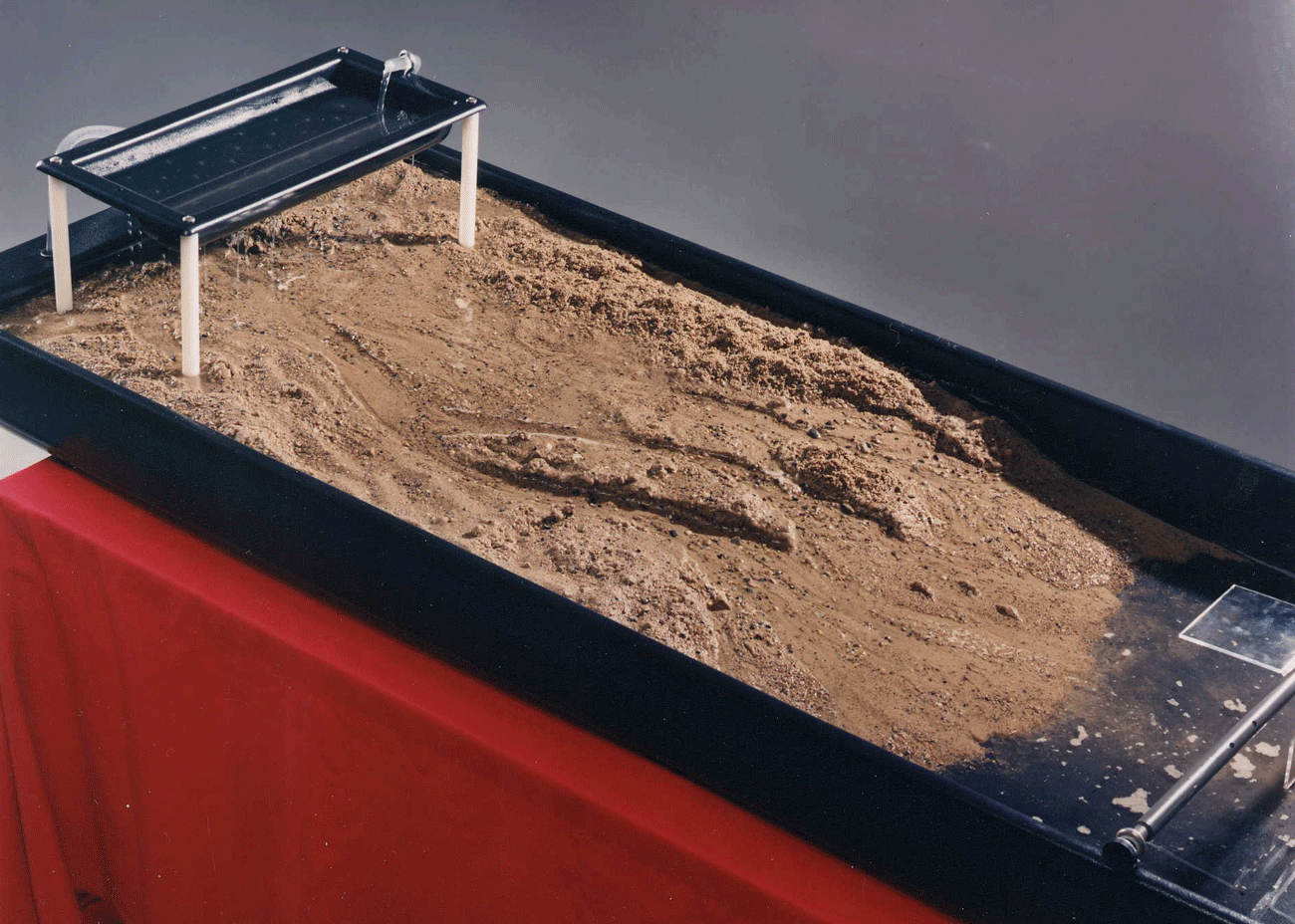
Stream tables give a straightforward and affordable way of learning the fluvial processes and their impact on landscape development. These tables help professionals and students visualize much better the dynamic and complex channel processes, which are otherwise difficult to understand, like stream deposition, transportation, erosion, or meandering. You can examine the effect of different factors on channel development, for example, the changes due to discharge or gradient variation. You can also expand your study of rivers by using a stream table in hands-on measurement regarding fluvial processes, advanced or introductory physical geography, or in classroom demonstrations.
What Is Happening in Our Rivers?
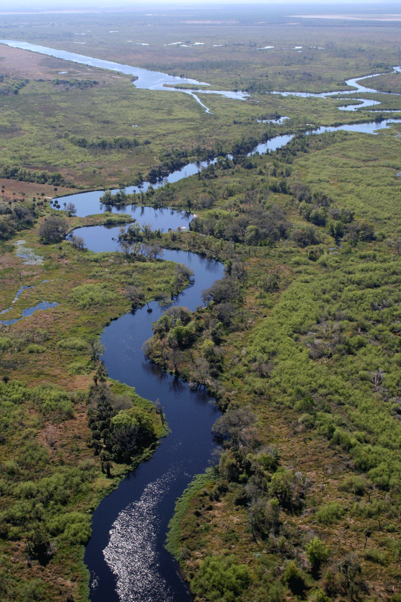
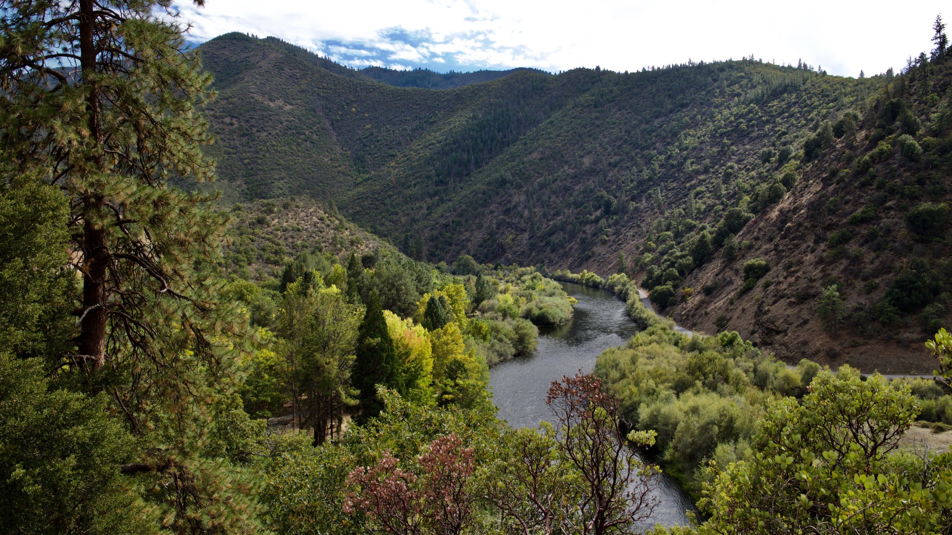
If you have been on a mountain, you’ve probably seen a beautiful waterfall and looked at the beginning of a stream. A river typically starts at the top of a hill, in which the water from melting snow or rain gathers. This collection of water runs down due to gravity and then forms rivers, streams, or brooks. As it flows downhill, it deposits sediments and erodes rocks, thus changing the landscape during the process.
You use a stream table to determine the variations on how the water flows through two landscapes. Aside from the differences, there are also similarities between the aspects. It depends on variables such as level of an inclined plane, topographical features, speed of the water, etc.
Observations
When using a stream table, you can find specific observations. This includes knowing that the degree of incline, topographical features, or any structures in its path will affect the speed of the water flow going downhill. Also, if the water flows faster, more erosion will happen. More sand is going to be collected at the bottom part. In the same manner, a river forms a delta at the mouth.
Goals for Studying the River Science
At the end of the activity, you will know the terms relating to geomorphic processes like velocity, slope, meanders, discharge, perennial, erosion, ephemeral, entrainment, gravity, deposition, and many others. You will learn the usage of a physical river model that represents natural systems. You will acquire basic ideas regarding streamflow, how the water through the channel affects the flow, and how various features of the water form. Moreover, you will gain an understanding of how people contribute to streamflow.
Keep in mind that while the water formation in the stream table appears fast, in reality, the establishment of a river can take up to millions of years from land to sea.